
Lackawanna County ZIP Code Coverage
The Lackawanna County ZIP code directory uses an official Pennsylvania county service-geography report as its regional inventory. It is not a claim that every address in each listed ZIP lies in the county. Postal delivery areas can cross county and municipal lines, and an individual address still needs Postal Service verification. The table preserves the report’s regional context and the limited local pairings documented in the research. Where no specific post-office name was verified, the table says to check the complete address through USPS.
| ZIP | Areas Covered | Post Office | Notes |
|---|---|---|---|
| 18403 | East county service region | Verify by USPS address lookup | Postal boundary can cross municipal or county lines. |
| 18407 | North county service region; Carbondale context | Verify exact address with USPS | Carbondale pairing appears in official state location lists. |
| 18411 | West county service region; Clarks Summit context | Verify exact address with USPS | Not a municipal boundary. |
| 18414 | North county service region | Verify by USPS address lookup | County-service geography. |
| 18419 | North county service region | Verify by USPS address lookup | County-service geography. |
| 18421 | North county service region | Verify by USPS address lookup | County-service geography. |
| 18424 | South county service region | Verify by USPS address lookup | County-service geography. |
| 18433 | North county service region | Verify by USPS address lookup | County-service geography. |
| 18434 | Central county service region | Verify by USPS address lookup | County-service geography. |
| 18436 | East county service region | Verify by USPS address lookup | County-service geography. |
| 18444 | South county service region; Moscow/Covington context | Verify exact address with USPS | County-service geography. |
| 18447 | Central county service region; Olyphant/Blakely context | Verify exact address with USPS | County-service geography. |
| 18452 | Central county service region | Verify by USPS address lookup | County-service geography. |
| 18472 | North county service region | Verify by USPS address lookup | County-service geography. |
| 18503 | Central county service region; downtown Scranton/Steamtown context | Downtown Scranton context | County government and courthouse vicinity use this postal context. |
| 18504 | Central county service region; West Scranton context | West Scranton context | Verify ZIP+4 for a physical address. |
| 18505 | Central county service region; West Scranton facility context | West Scranton context | Postal and municipal boundaries differ. |
| 18507 | South county service region | Verify by USPS address lookup | County-service geography. |
| 18508 | Central county service region; North Scranton context | North Scranton context | County-service geography. |
| 18509 | Central county service region | Verify by USPS address lookup | County-service geography. |
| 18510 | Central county service region | Verify by USPS address lookup | County-service geography. |
| 18512 | Central county service region; Dunmore context | Dunmore context | County-service geography. |
| 18517 | West county service region; Taylor context | Taylor context | County-service geography. |
| 18518 | West county service region; Old Forge context | Old Forge context | County-service geography. |
| 18519 | Central county service region; Dickson City context | Dickson City context | County-service geography. |
| 18641 | South county service region | Verify by USPS address lookup | ZIP can reach across the county line. |
The Pennsylvania county ZIP-region report supports the regional list. Use the Postal Service and county GIS to audit one physical address rather than assuming a regional label resolves a parcel or municipality.
Verify a Lackawanna County ZIP
The USPS ZIP Code Lookup is the first verification channel for a complete physical address. Enter the full address and preserve the returned ZIP and ZIP+4 as postal-routing information. Then use the full street address or PIN in county property systems. This sequence matters because the county Assessment Database does not advertise a ZIP-mode search, and the county tax page places ZIP in the owner mailing-information area rather than offering it as a geographic parcel filter.
The USPS address-to-ZIP verification screen is shown below. It confirms a mailing route, which is useful before searching county records but does not identify a municipality, tax district, precinct, parcel, or every person at an address.
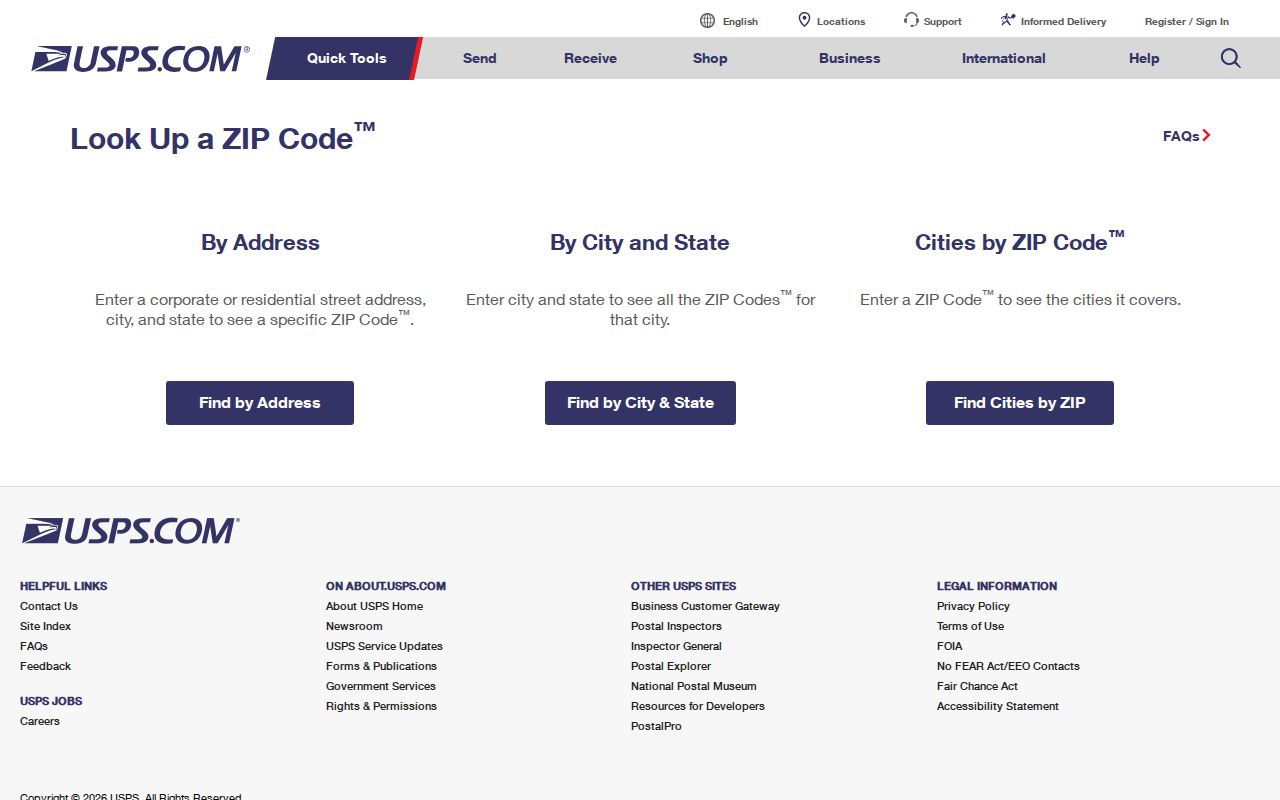
After USPS returns a ZIP result, check the county GIS municipal-boundary layer and the parcel record. This converts a postal clue into the government geography used by local custodians.
Lackawanna County ZIP Code Search Fields
No ZIP-wide geographic filter on the Lackawanna assessment, GIS, or voter web form was verified in the research. The documented ZIP-capable county field is the tax search’s mailing ZIP field, which is not a parcel-boundary query. The field table makes that limitation clear. For a real property search, first turn the ZIP result into a full address, then use Location Address, owner name, or PIN.
| Portal field | Type | What it is for | ZIP-directory limit |
|---|---|---|---|
| PIN | Optional text | Property identifier in current-year tax search. | Stronger property key than ZIP. |
| Location Address | Optional text | House number and street name only. | Use after postal verification. |
| Name | Optional text | Owner-information search with last-name-first examples. | Not a ZIP-wide people search. |
| Mailing Address and City | Optional text | Tax-mail destination fields. | Separate from the parcel situs. |
| ZIP | Optional text | Mailing ZIP within owner information. | Not a verified geographic parcel filter. |
| Bill Type | Selection control | County or Municipal/School bill path. | Choose the bill route, not a postal region. |
The current-year tax search is pictured here. Its on-screen instruction says to enter only the name as it appears on the tax bill and then search, a useful warning against filling several identifiers at once.
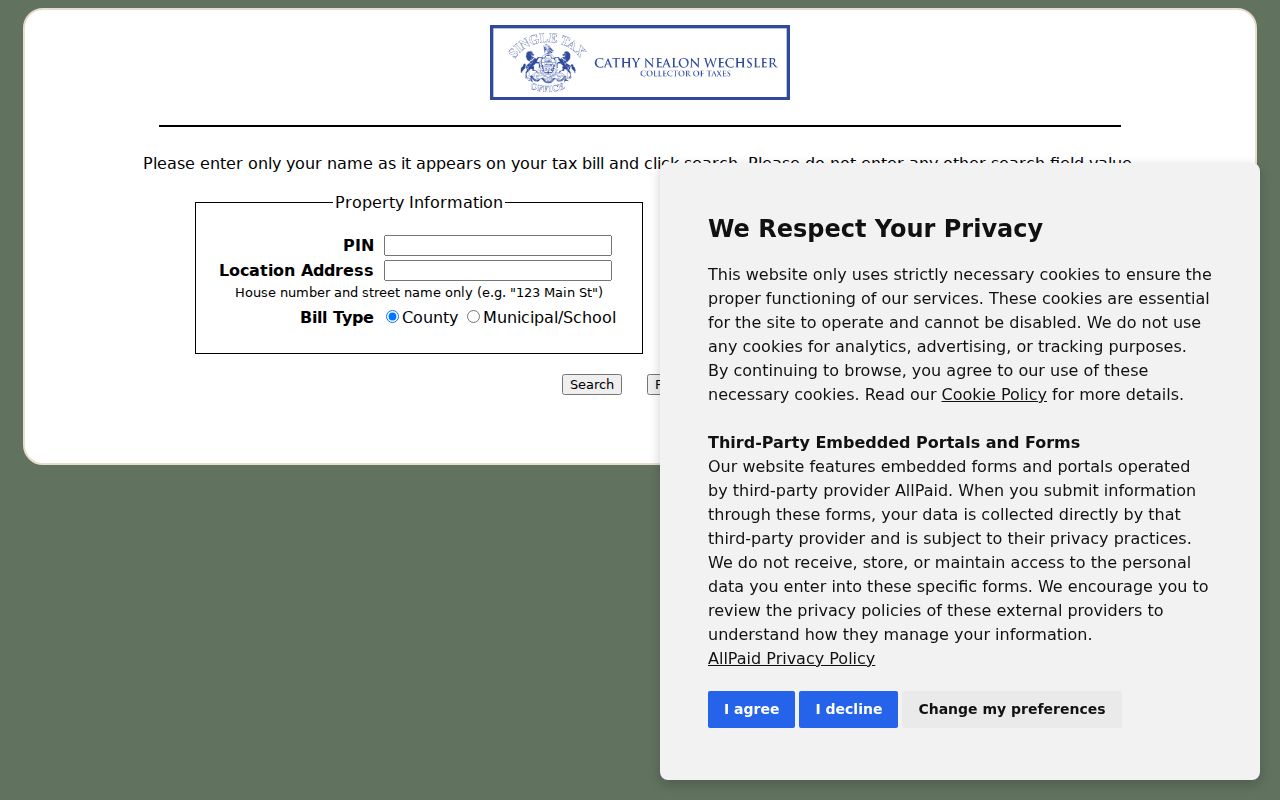
Use the tax record to compare fields once a parcel is known. Do not represent its ZIP box as a way to obtain all parcels or residents in a postal area.
Lackawanna County ZIP Mailing Fields
A ZIP code in a tax result belongs to a different address concept than the situs. The county’s current-year tax page separates Location Address, which identifies the billed property, from Name, Mailing Address, City, and ZIP in the owner-information area. A mail destination may be a post-office box, another property, a business, a representative’s address, or a place outside Lackawanna County. It is not proof that a person occupies the parcel.
Insider tip. Keep the fields separate in research notes: situs for the physical parcel, mailing address for tax correspondence, and legal description for the recorded land description. That simple separation prevents a postal address from being treated as a municipal or property boundary.
Note: A ZIP field in the tax search narrows mail information, not the county’s parcel geography.
Find Records from a ZIP Code
A Lackawanna County ZIP code directory workflow does not begin with a bulk resident filter because none was verified for the county’s assessment, GIS, or voter web forms. Instead, use postal verification to narrow a known address, then move through the county systems that are actually keyed to property, municipality, or recorded document. Pennsylvania’s online voter-status tool is a personal status channel, not a postal-area browser. The public election-list pathway is governed by a separate written-request process and may be arranged by street and house number under its statutory limits.
- Enter the complete physical address in USPS ZIP Code Lookup and retain the returned ZIP or ZIP+4.
- Use the full address in the county GISViewer to confirm municipal and parcel context.
- Search the address, owner, or parcel identifier in the Assessment Database, then compare the separate tax fields only where needed.
- When a recorded ownership trail is relevant, use the parcel clues and legal description in the Recorder’s document index.
- For a local request, contact the municipality or county office that holds the specific file rather than treating the ZIP as its jurisdiction.
Once the ZIP clue has become a physical address, the Lackawanna County street directory supplies the fuller address-to-parcel and deed-chain route.
Lackawanna County ZIP Municipal Lines
A ZIP code is a Postal Service delivery-routing designation. It is not a municipal boundary, tax district, election precinct, or parcel identifier. County GIS identifies 40 municipalities, and an address can carry one mailing city name while lying in a different local government area. The regional table itself shows the risk: 18641 can reach across the county line, while several other ZIPs have a named postal context but still require exact-address verification.
- ZIP and ZIP+4
- A ZIP is the main postal-routing code; ZIP+4 adds delivery-routing detail returned for a complete address.
- PO-box ZIP
- A ZIP used for post-office-box delivery. It should not be assumed to describe the physical location of a parcel.
- Unique ZIP
- A postal code assigned for a single organization or delivery arrangement. No Lackawanna County example was verified here.
- Carrier route
- A Postal Service delivery grouping. It is not a county parcel, municipal boundary, or resident roster.
Lackawanna County Address Keys
County property records use stronger identifiers than ZIP alone. The Assessment Database supports owner, street-address, and parcel-ID searching. The tax system accepts a PIN or Location Address. The Recorder’s document chain uses named parties and the legal description, such as lot, block, subdivision, or metes-and-bounds terms. Those land-description clues are more stable through a numbering change than a postal reference.
The official Assessment Database landing page identifies the owner, address, and parcel-ID routes available to the public.
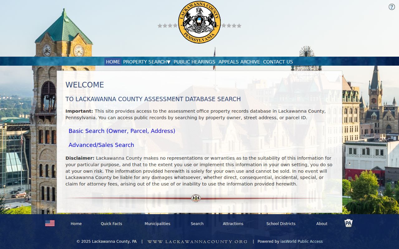
Start an address-based record search with the current number as it is used now. Preserve the parcel ID and legal-description language when a deed or historical source must be connected to the same land.
Lackawanna County ZIP Record Context
The Lackawanna County Assessment Office evaluates real estate and links to the county database. Its 2025 comprehensive reassessment was the first in nearly 60 years and brought values from a 1968 basis to current market levels. That is a timing caution for ZIP-based research: a current parcel description, value, or photograph may reflect a recent county project rather than the date of a transfer, move, or historic address reference.
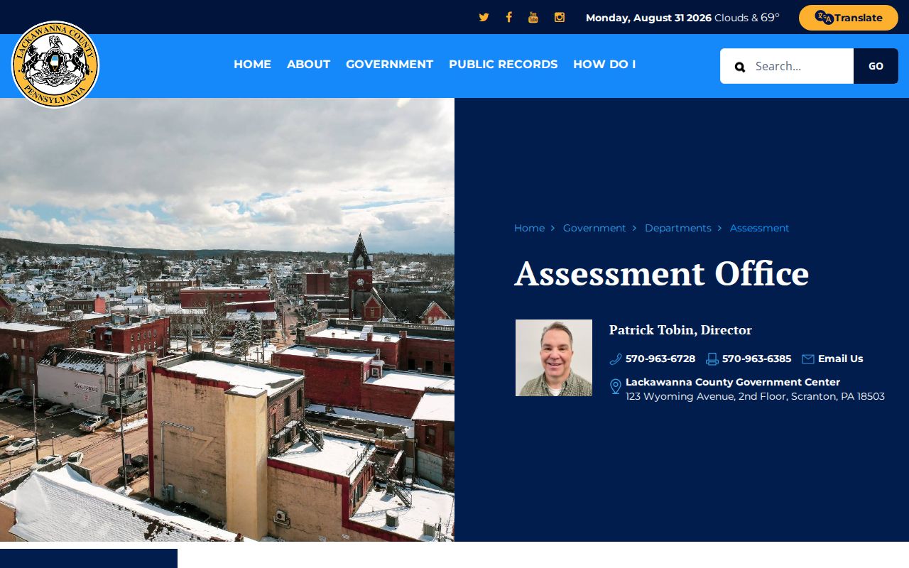
The Assessment Office page is shown below. Keep the source screen date beside any ZIP code directory note because assessment data updates weekly, maps daily, and photographs quarterly.
Scranton is the county seat, but it is not the whole county. Carbondale, Abington, and other localities may appear under distinct library, newspaper, historical, municipal, and postal conventions. Preserve the place label as printed until GIS and the parcel record establish the proper modern municipal context.
Note: Current assessment information should be dated before it is compared with an older address or deed.
Historic Lackawanna County ZIP Clues
Modern ZIP codes do not organize older city directories, Sanborn maps, or many deed records. Historical sources generally use street names, house numbers, municipalities, or legal descriptions instead. For a historic address, begin with the postal ZIP only to verify a current location, then shift to the street and parcel keys used by the source’s own era. That keeps a present-day routing code from being projected backward onto a nineteenth- or early twentieth-century record.
Scranton Sanborn editions are documented for 1884, 1888, 1898, and 1919-1920. They can provide building and street context but are not people lists. Pair a map with a directory, deed, estate, or newspaper date before drawing a household conclusion.
Lackawanna County ZIP Code Limits
Myth: a ZIP code identifies a single city, government jurisdiction, or complete group of residents. In Lackawanna County, it does none of those things. A postal route can cross municipal or county lines, and the county’s own record systems prioritize the street address, parcel ID, owner field, or legal description. A mailing ZIP in a tax record can be separate from the physical parcel. A property owner or a map label also cannot establish every occupant at an address.
Use public postal and property information for legitimate personal research, family history, estate questions, consumer safety, or civic context. Do not combine public fragments to stalk, harass, intimidate, or harm anyone. Where an address is protected through the Pennsylvania Address Confidentiality Program, do not try to reconstruct it from other sources.